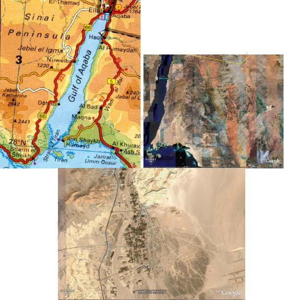
This information is NOT for those critics who have set their hearts against the truth. No matter how strong the evidence, it would be wasted on them. The battle lines have been drawn and the ranks are becoming clearly defined. The answers in this section are presented for the benefit of the countless honest folks who genuinely want to know the truth concerning the Discoveries claims. This includes many who are sharing the news and need extra information for genuine enquirers.
1) Isn’t the Exodus story a myth?
There
is an ancient Egyptian papyrus document called the Ipuwer Papyrus,
which seems to recount in eye-witness fashion the plague of blood, the
plague of cattle, the plague of strange fire, the plague on the
firstborn, as well as the strange darkness – events previously known
only from the Bible, in the book of Exodus.
The
Ipuwer Papyrus, often referred to as the Papyrus Ipuwer, is believed to
have been written between 1,600 B.C. and 1,850 B.C. The oldest copy in
existence was purchased from a collector in 1828 and translated into
English in 1909. Currently the Ipuwer Papyrus resides in the Dutch
National Museum of Antiquities in Leiden, Netherlands. This small piece
of papyrus has sparked a great deal of debate and scholars remain
divided over its true meaning and purpose. The primary interest for our
purposes are the striking similarities to the plagues recorded in the
book of Exodus.
The Similarities
First
let’s take a look at the similarities between the Ipuwer Papyrus and
the Book of Exodus. There is no denying the two are shockingly similar
and it should come as no surprise that many use the papyrus in their
arguments for the story of the plagues being historical fact.
1) Exodus 7:20 – “And all the waters that were in the river were turned to blood.” – Ipuwer – “The river is blood”
2) Exodus 7:24 – “And all the Egyptians digged round about the river for water to drink, for they could not drink of the water of the river.” – Ipuwer – “Men… thirst after water.”
3) Exodus 9:23 – “…and fire ran along upon the ground.” – Ipuwer – “Gates, columns and walls are consumed by fire.”
4) Exodus 9:31 – “And the flax and the barley was smitten:for the barley was in the ear.” – Ipuwer – “Everywhere barley has perished.”
5) Exodus 9:3 – ” …upon the horses, upon the asses, upon the camels, upon the oxen, and upon the sheep: there shall be a very grievous murrain .” – Ipuwer – “The cattle moan because of the state of the land.”
6) Exodus 12:29 – “…the Lord smote all the firstborn in the land of Egypt…” – Ipuwer – “Men are few, and he who places his brother in the land is everywhere – The children of princes are dashed against the walls.”
7) Exodus 10:22 – “And Moses stretched forth his hand toward heaven, and there was a thick darkness in all the land of Egypt three days.” – Ipuwer – ” The land was not light or bright.”
8) Exodus 12:35 – “…the children of Israel… borrowed of the Egyptians jewels of silver, and jewels of gold, and raiment” – Ipuwer – “Gold, lapis lazuli, silver … are strung on the necks of maidservants.”
The
Iupwer also speaks of a pestilence throughout the land and the collapse
of order that servants are leaving their servitude and acting
Rebelliously. Some translations tell how the king has been taken away by
poor men.
All
of these examples show how many people, some scholars included, have
claimed the Ipuwer Papyrus to be speaking of the plagues as recorded in
the Bible. When read in this manner it is in fact hard to deny the
similarities and to come to any other conclusion. However, when read in
its entirety, the Ipuwer Papyrus takes on an entirely new meaning to
many scholars.
Interestingly,
some scholars believe the papyrus recorded the events immediately
following the plagues when the land of Egypt was invaded and conquered.
Given the condition of the country, and its armies, after the plagues it
should not come as any surprise that Egypt’s advisories would take
advantage of the opportunity and invade. In one line the Ipuwer records,
” The stranger people from outside are come into Egypt.” Only one of
the eight examples listed above seem to relate to an invasion. Example
number eight could easily be seen as the result of an invasion by a
conquering army.
It
would be difficult to believe that two independently written documents,
recording similar events all of which take place in Egypt, can be so
similar and are in no way related to one another. To what degree they
are connected is difficult if not impossible to determine. While any
connection to the book of Exodus is hotly debated and refuted by many
scholars, the Ipuwer Papyrus remains an interesting element worthy of
study and further evaluation.
We
also can rely on the bible account as well. The five books of Moses
(including Exodus) abound with Egyptian words, roots and phrases, as
would be expected of a writer who had come out of Egypt.
In
1980, a computer analysis of the vocabulary of these books were
undertaken at the Hebrew University in Jerusalem. The result: these five
books were confirmed as having the same author (not from a collection
of scribes). William F. Albright, reputed as one of the greatest
archaeologist states:
“The contents of our pentateuch [the five book of Moses] are, in general, very much older than the date at which they were finally edited; new discoveries continue to confirm the historical accuracy or the literary antiquity of detail after detail in it….It is, accordingly, sheer hypercriticism to deny substantially Mosaic character of the pentateuchal tradition.” (CH Dodd, More New Testament Studies, p.224. Manchester University Press, 1968.)
2) Where were the various stops along the Exodus route from Egypt to the Red Sea?
We shall break up the answer to this question under the following headings:
- Where was Rameses?
- Where was Succoth?
- Where was Etham?
- Where was Pihahiroth?
- Where was the crossing spot?
- Where was Migdol?
- Where was Baalzephon?
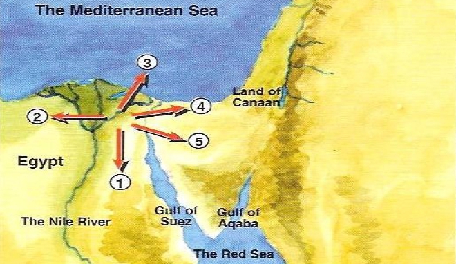
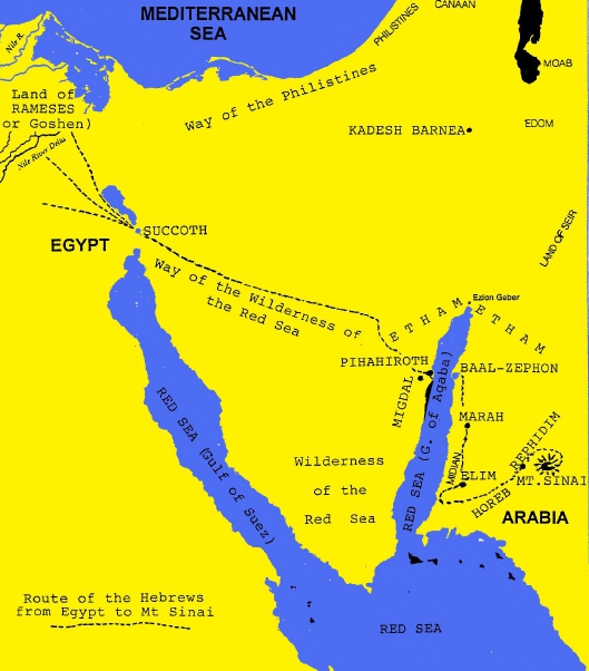
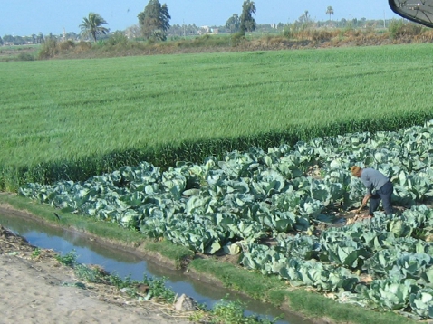
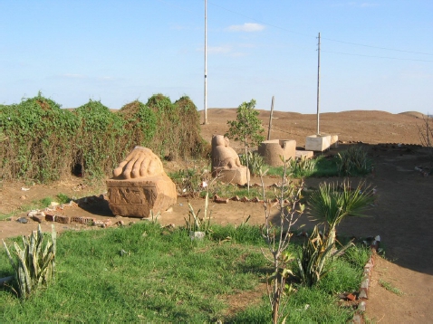
3) Where was Rameses?
Firstly, the Israelites travelled from Rameses to Succoth (Exodus 12:37). There was a city with a similar name (Rameses – Exodus 1:11).
However, this was distinct from the land of Rameses. Rameses was the
Delta region, the land given to Joseph’s family to live in by the
Pharaoh. This was called “the land of Rameses” and “the land of Goshen”.
And here the great population of the Hebrews lived:
“And Joseph placed his father and his brethern, and gave them a possession in the land of Egypt, in the best of the land , in the land of Rameses, as Pharaoh commanded” Genesis 47:11.“And Israel dwelt in the land of Egypt, in the country of Goshen; and they had possessions therein, and grew, and multiplied exceedingly” Genesis 47:27.
Eventually,
when the time came for the Exodus, the slaves left their homes in
Rameses (Goshen) and proceeded to leave Egypt “proper”. They assembled
in Succoth, which was very near, yet outside of the boundary of Egypt
“proper.”
4) Where was Succoth?
Moses gathered the Israelties (Hebrews) at Succoth (Exodus 12:37).
Succoth had to be a place large enough for this tremendous amount of people and flocks to assemble.
“Succoth”
is a Hebrew transliteration of the Egyptian “Tjeku” mentioned in
Egyptian documents as a border station. It was also known as “Tharu”.
In
ancient Egypt there was a line of guarded fortifications along the canal
which connected the Gulf of Suez with the Mediterranean sea. This canal
is known to have existed anciently, by satellite photos and infra-red
photos, which still show its path. At the border – the point where one
would leave Egypt proper and go into the Sinai desert, there was a
fortress and a bridge.
“The
Isthmus of Suez was of greatest consequence also from a military point
of view – it was doubtless fortified in very early times. Probably here
stood the great fortress of T’aru, often spoken of as the starting point
for the expeditions into Syria….” Adolf Erman, Life in Egypt, p.28
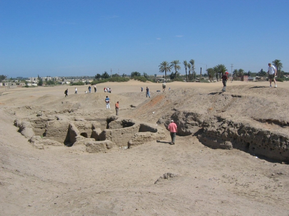
“The
line of fortifications which was intended to keep back these Bedouins
of the Delta, is met with as early as the time of the Middle Empire, and
is still standing. It consisted of a wall strengthened by small
towers….; this formed an obstruction which the slaves who tried to
escape from Egypt, and the Bedouins who wanted to pasture their cattle
on the fields of the Delta, found difficult to pass. At this time we
also meet with a defensive work of another kind namely a broad canal,
which presumably connected the lakes of the isthmus together. At the
point where a bridge crossed this canal were strong fortresses on both
sides…..The great fortress which defended this bridge was the fortress
of T’aru; which is so often mentioned as the starting point of the
military expeditions.” Aldolf Erman, Life in Egypt, p.537
This
was located near the Delta where the Israelites were living. “Tharu” was
where the Egyptian army assembled in preparation for their military
expeditions to the north. Armies consisted of a great deal of men,
horses and chariots; and they required a large area to assemble
properly.
Moses
well knew Tharu, called “Succoth” in the Biblical account – and it was
here that he orgainzed the people for their journey. They had left Egypt
proper once they crossed this line of fortification, just as the Lord
had promised.
“……and the children of Israel went up harnessed out of the land of Egypt” Exodus 13:18
The
term “harnessed” indicates that they went out not as a mob of fleeing
fugitives, but as a well orgainzed body. The Hebrew word “chamushim”
(translated “harnessed”) means “in ranks.”
Remember,
Moses, as “the son of Pharaoh’s daughter”, was heir to the throne of
Egypt. As such, he under went training with the priesthood and the
military:
“Moses was learned in all the wisdom of the Egyptians, and was mighty in words and deeds” (Acts 7:22)
Yes,
Moses was thoroughly trained in all aspects of military leadership and
would have known well how to assemble large numbers of people for
travel. The fact that Moses was indeed a general in the Egyptian army
seems to have been a well-known fact. Josephus writes about this in his
Antiquities of the Jews, Bk.2 and ch.X. As a military man, once again,
Moses knew “Tharu”, and it was here that he orgainzed his largest “army”
ever travel. And from this assembly point, they travelled to Etham.
5) Where was Etham?
“And they took their journey from Succoth, and encamped in Etham, in the edge of the wilderness” Exodus 13:20
From Succoth there were 2 highways to Cannan:
– Route A – “the way of the Philistines” – the shorter route (v.17);
– Route B – “the way of the wilderness of the Red Sea” – the southern route (v.18).
This
southern route took them by the wilderness of the Red Sea – the area
between the 2 arms of the Red Sea. Etham was in the “edge of the
wilderness”. What wilderness was this? The answer is in the Exodus
account:
“But God led the people about, through the way of the wilderness of the Red Sea” Exodus 13:18.
It
was the Wilderness of the Red Sea – the mountainous land of the mid and
southern Sinai Peninsula. This was along a route that was commonly taken
in those days by both caravans and the army, and it was called “the
southern route”. This route was taken because it was safer than
travelling along the coastal “northern” route, where the Philistines
were.
Etham
was not a singular location, but a region. How do we know this? Because
they were in Etham BEFORE they crossed the Red Sea (Exodus 13:20). And they were still in an area called Etham AFTER they crossed the sea (Numbers 33:8). Etham was, therefore, a designation of the land that lay around the mid-northern edge of the Gulf of Aqaba.
6) Where was Pihahiroth?
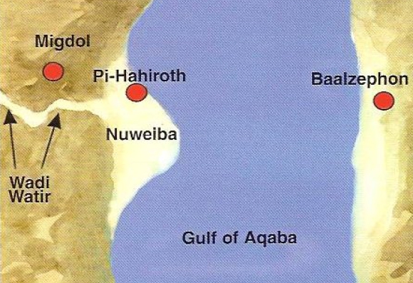
It was while they were in Etham on the western side of the sea that God told Moses:
“Speak unto the children of Israel, that they turn and encamp before Pihahiroth, between Migdol and the sea, over against Baalzephon; before it ye shall encamp by the sea. For Pharaoh will say of the children of Israel, they are entangled in the land, the wilderness hath shut them in” Exodus 14:2,3.
To be
“entangled in the land”, they would have to be travelling through an
area with mountains all round, hemming them in. This is BEFORE crossing
the sea.
So from Etham they changed their direction of travel (“that they turn”) and went south.
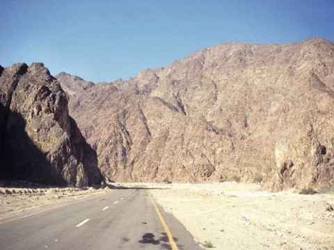
They
found themselves entering the mountains, along a dry river bed system
that must have appeared like an endless maze to them. The 27 kilometer
(17 mile) Wadi Watir is a natural highway from Egypt.
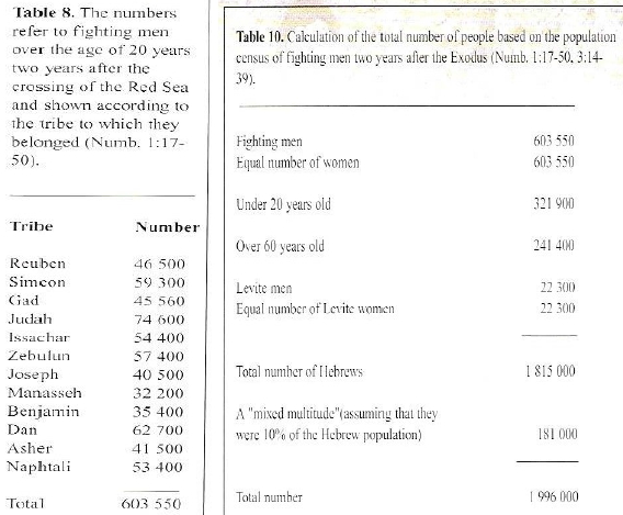
The multitude comprised 603,000 men, as well as women and children – perhaps as many as two million people.
As
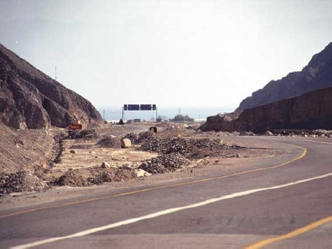
the great multitude WEAVED their way through this awesome and wild
canyon, it would appear that they were entangled. Hemmed in to the left
and right, they could travel in only one direction. The only path
through that wadi leads to an enormous beach – so big that it can be
seen on satellite maps.
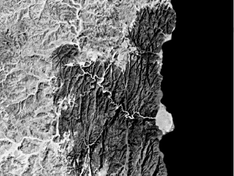
The
beach head is named today “Nuweiba”. The root of this name suggests
that some misfortunate incident happened here (Haas Wehr Arabic-English
dictionary). It is speculative to say whether or not it refers to the
drowning of the Egyptian army in the Red Sea.
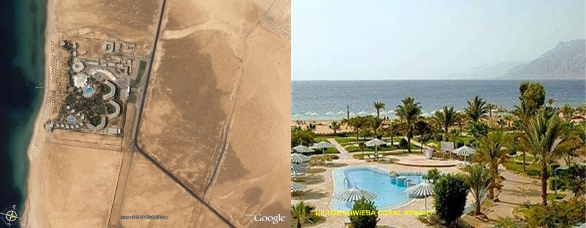
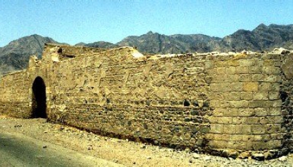
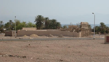
On
the north end of the beach area are the remains of an ancient Egyptian
fortress – another evidence that Egyptian territory extended all the way
through the Sinai Peninsula. We believe this was Pihahiroth.
Pihahiroth
means; “Mouth of Gorges” (Strong’s concordance). As was the typical
custom of the people of that time, they named it after an attribute of
the geology of that place.
7) Where was the crossing spot?
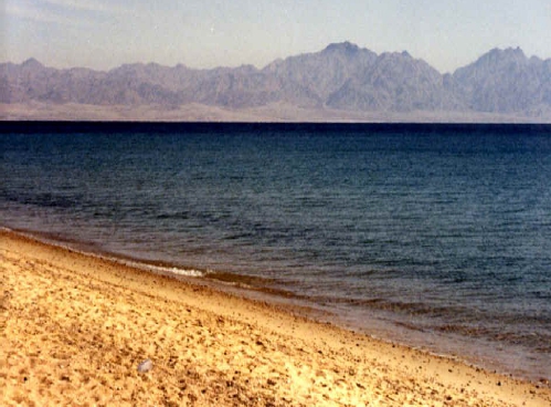
The
Wadi Watir leads to a wide expanse of beach on the Gulf of Aqaba arm of
the Red Sea, which could easily have held the multitude, their flocks
and also Pharaohs pursuing army – separating the two groups by several
kilometres.
This
beach at Nuwebia is so large (7km by 3km); it can easily be seen on
satellite maps. It is the only place that matches all the requirements
of our checklist.
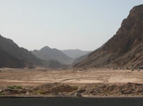
Closed in by mountains to the sea; the wilderness “shut them in” Exodus 14:3.
Josephus adds that the Hebrews were shut up:
“between the inaccessible precipices and the sea; for there was (on each side) a range of mountains that terminated at the sea, which was impassable by reason of their roughness, and obstructed their flight…..where (the ridges of) the mountains were closed with the sea.” (Antiquities of the Jews, book II, ch.XV)
8) Where was Migdol?
As
they were now encamped between Migdol and the sea, Migdol could be
either the mountains to the west, which make a perfect barrier,
enclosing them on the beach, or it may have been a watch-tower atop one
of those mountains. (The name “Migdol” means “tower” or “fortress”).
The
Egyptians had watch-posts all through the Sinai Peninsula. It is
documented that they flashed messages from tower-to-tower by day and
night, using reflected light. Perhaps this is how Pharaoh knew exactly
where the escaped slaves had gone.
9) Where was Baalzephon?
“And the Lord spake unto Moses, saying, Speak unto the children of Israel, that they turn and encamp before Pihahiroth, between Migdol and the sea, over against Baalzephon: before it shall ye encamp by the sea.” Exodus 14:1,2
On
the opposite shore, in Saudi Arabia, precisely across from where they
camped by the sea, is another ancient structure. All alone on the beach,
it may have been a Midianite fortress, dedicated to Baal; we believe
this could be Baalzephon. The phrase “over against” seems to mean
“opposite from” in respect to being across a body of water. (As, for
example, in Deuteronomy 32:49 “……in the land of Moab, that is over against Jericho” – meaning across the Jordan River from Jericho).
10) Isn’t the Gulf of Aqaba too far from Egypt? Wouldn’t it have taken too long to get there?
The record says that they travelled both day and night (Exodus 13:21).
This means they did not stop and camp much at all. Knowing that the
Egyptians would spend time in mourning and burying their dead as a
result of the tenth plague, they knew the Egyptians would be bent on
revenge. THEY WERE IN A HURRY!
The
journey to the Gulf of Aqaba, suggests that this trip was accomplished
by a miracle! We suggest it was not an easy, short trip, such as to Suez
(as tradition suggests!) Rather, it was a journey of such magnitude
that it could not be accomplished in their own strength. We are told in
Scripture that this Israelite trip was accomplished by a miracle;
“Ye have seen what I did unto the Egyptians and how I bare you ON EAGLES WINGS..” Exodus 19:4.
Again,
we are told in Scripture, that this Israelite trip was accomplished by a
miracle – just as was their 40 year wilderness wandering.
“And I have led you forty years in the wilderness: your clothes are not waxen old upon you, and thy shoe is not waxen old upon thy foot” Deuteronomy 29:5
When the Bible mentions an eagle it usually refers to ‘SWIFTNESS’. For example in Daniel 7:4 a Leopard is depicted with EAGLES WINGS. This denotes Alexander the Great’s SPEED of conquest.
Other examples:You get the picture!“a nation as SWIFT as the EAGLE” Deuteronomy 28:49“as the EAGLE that HASTETH” Job 9:26“were SWIFTER than EAGLES” 2nd Samuel 1:23“are SWIFTER than EAGLES” Jeremiah 4:13“SWIFTER than EAGLES” Lamentations 4:19
In Exodus 19:4,
the implication is that their journey was a MIRACLE – that the
Israelites were supernaturally strengthened to accomplish this journey
swiftly. Because the distance was NOT SHORT, BUT LONG.
If
the distance was only to the Gulf of Suez you would not need a miracle
to get there quickly. Thus, the Biblical account does not suggest a
short, but rather a long distance – which required travelling by both
day and night.
The question arises, is it possible to travel to the Gulf of Aqaba on foot in three days and nights?
The
distance from the Suez Canal to Nuweiba is 336km (210 miles). In 1967,
Israel’s Moshe Dayan marched his troops ON FOOT over the same route, in
reverse, that the Hebrews took – between Succoth and the Gulf of Aqaba.
Marching only by day they did it in 6 days. And the modern Israeli
marchers camped at night.
The Hebrews did not stop and camp every night, as Moshe Dayan’s troops did – they travelled both day and night:
“And the LORD went before them by day in a pillar of cloud, to lead them the way; and by night in a pillar of fire, to give them light; to go by day and night” Exodus 13:21.
With
divine assistance, this huge mass of people travelled in an orderly
manner both day and night, with great speed: “Ye have seen what I did to
the Egyptians, and how I bore you on eagles wings”.
Even
if they accomplished the trip in 3 days and 3 nights (equivalent to the 6
days of marching on foot performed by the Israeli troops over the same
distance), that would be at an average speed of no more than 4.67km (2.9
miles) per hour.
11) Why do Exodus Route Maps put some of the cities differently, where you claim them to be?
Since
scholars have placed Mt.Sinai in Egyptian territory, they are compelled
as a result to locate all of the preliminary stops likewise on the
traditional Sinai Peninsula.
This
impediment of miss-alignment with the Biblical account that the
conventionally trained scholars have inherited, has led them into trying
all sorts of clumsy techniques to make their theory fit. Their maps of
the route often wildly disagree – since they are based only on
speculation. Some of the map-makers are honest enough to insert question
marks (?) after each name.
In 1992, Harvey Arden wrote in National Geographic:
“Hardly a place-name in the Bible’s Exodus narrative can be fixed on a map with any certainty…..conjectures about Sinai’s…..unclear Biblical past – whether the route of the Exodus, the location of the “real” Mount Sinai, or the origin of the pillar of fire – must be taken with a few grains – indeed, a dune – of desert sand…..I came to Uyun Musa, ‘Springs of Moses’, about 15 kilometers from Suez….Again, only speculation.” (April 1992 pp 420-461)
12) Why do the vast majority of Scholars reject this Red Sea discovery?
Micheal
Lemonick (U.S. Time Magazine) would tell us that “most scholars suspect
that Abraham, Isaac and Jacob….never existed; many doubt the tales of
slavery in Egypt and the Exodus” Time, December 18th, 1995.
Are we therefore safe in trusting the opinions of the vast majority of Biblical scholars? Says the Scripture:
“Ye have plowed wickedness….ye have eaten the fruit of lies: because thou didst trust in thy way, in the multitude of thy mighty men.” Hosea 10:13
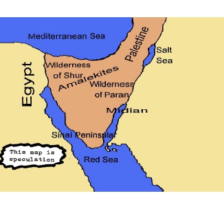
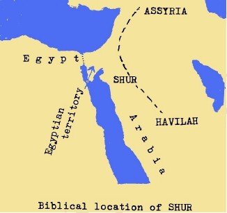
13) Didn’t the crossing occur at the “sea of reeds or bitter lakes” at the eastern border of Egypt?
Confusion over the Red Sea crossing stems from a wrong location for Mt.Sinai, which the Hebrews reached after the crossing.
Mt.Sinai
as we know it today was land marked by St.Helena in the 4th Century AD.
The story has it that she went around the Israeli & Middle Eastern
area with a group of men and landmarked places that fit her own ideas.
Subsequently, the Church picked these up as traditional historical spots
for biblical events. Since the marking of modern Mt.Sinai by Helena and
adherence to it by the established Church many Christians had
difficulty reconciling the Red Sea crossing. Stories have been concocted
that the water was only a marsh, a couple of feet deep – and that this
Exodus path went over the area of what over the area of what over the
area of what is today the Suez Canal.
Now it really would have been a “miracle” to drown Pharaoh’s army in only 2 feet of water!
Sea of Reeds = also the Gulf of Aqaba.
Some
people determine to support the Exodus as crossing marshlands from the
Hebrew words used in the Bible to name the Red Sea: “yam soof”, which
means “Sea of Reeds”. These words are still used by the Jews today, but
they are used to name the entire Red Sea including the Gulf of Aqaba and
the Gulf of Suez.
Regarding
a marshland, or lake. Think now. Would it make sense for the Hebrews to
flee through a lake, when all they needed to do was to go around it?
In any case, marshland crossing does not fit the Biblical account, which describes the crossing spot as “the heart of the sea” Exodus 15:8. The Suez Canal area is NOT “the heart of the sea”. The Suez Canal is NOT the RED SEA.
With
all of the digging that went on to construct the modern Suez Canal, not
to mention the clearing of that canal after the first Egyptian-Israeli
war, not one wheel of Pharaoh’s drowned army in that spot was ever
found.
Firstly,
we have shown that the Hebrews under Moses assembled at Succoth, which
is OUTSIDE of Egypt. From this point armies or caravan assemblies used
to strike SE across the Wilderness of the Red Sea to distant places. At
no time was there any reason for them to have to cross the upper reach
of the Red Sea (Suez branch), nor did they have any necessity to cross
any of the Bitter Lakes. All they had to do was bypass either of these
masses of water if they were encountered. This is clear from any map.
Look
at the map again! At the proposed crossing site south of Suez along the
Egyptian shore, if the Hebrews were facing the Gulf of Suez, ready to
cross, in which country would they still be standing? The answer is,
they would still be on Egyptian soil!! One is still in Egypt, as one
faces the proposed Red Sea crossing at the Gulf of Suez.
Egypt
borders the entire western shore of the Gulf of Suez. Whatever the
Hebrews camped along that coast, they would still be in Egypt. However,
the book of Exodus tells us that before they came to the Red Sea
crossing, they had ALREADY LEFT Egypt.
The “children of Israel went up harnessed OUT OF the land of Egypt.” Exodus 13:18.
So, when they later arrived at the Red Sea and found themselves
trapped, they complained to Moses their leader, “Because there were no
graves in Egypt, hast thou taken us away to die in the wilderness?” They
asked why Moses has carried them forth “OUT OF Egypt….we did tell thee
IN Egypt, saying, Let us alone” Exodus 14:10-12.
You notice, when they found themselves trapped BEFORE crossing the Red Sea, they were already OUT OF EGYPT.
Secondly,
the proposed crossing spot in the Gulf of Suez is “comparatively
shallow.” The Suez area is not deep! When the sea rolled back according
to the Bible account, there was not one survivor.
I ask
you, would 250,000 soldiers (Josephu’s figure) all drown in just 3 to 4
metres of water? Every one of them? And likewise, thousands of strong
horses? And how come the multitude of chariots has not been found in
such shallow water, to this day?
Those
who insist on a Lake Timsah or Suez crossing ALWAYS emphasize how
shallow the water was. Shallow water couldn’t have swamped Pharaoh and
his army!
But what does the Bible say concerning the true crossing spot? Was it SHALLOW or DEEP? Let the Scriptures speak:
- the GREAT DEEP Isaiah 51:10
- the MIGHTY WATERS Isaiah 43:16-17
- the DEEP Isaiah 63:11-13
- the DEPTHS have covered them Exodus 15:5
- the DEPTHS were congealed in the HEART OF THE SEA Exodus 15:8
- into the DEEPS” Nehemiah 9:11
Every
single one of these texts is describing the Red Sea crossing spot! The
Gulf of Suez is “shallow.” The Gulf of Aqaba is “the great DEEP” – up to
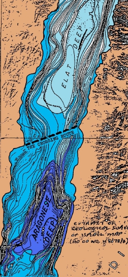
5,400 feet deep – with a ridge crossing it between two deeps!
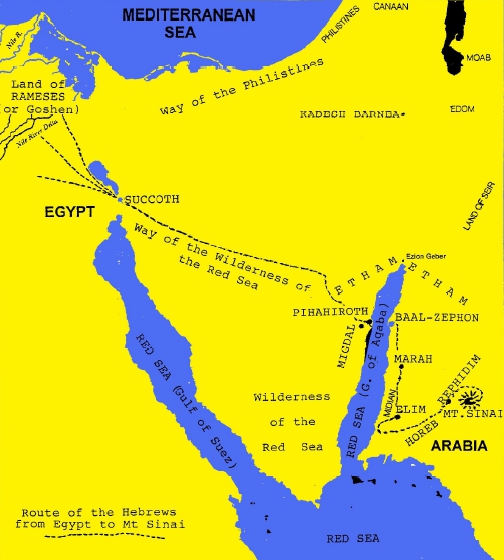
14) Isn’t the Gulf of Aqaba too deep to cross?
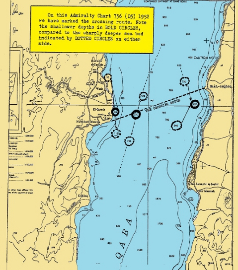
Nautical
charts show the Gulf of Aqaba arm of the Red Sea to be an underwater
trench more than 5,000 feet (1,600 meters) deep in places. That’s
positively “DEEP.” The Western shoreline drops steeply underwater into
this “canyon” at a slope of 45 degrees. However, at the precise location
of Nuweiba beach, the deep trench is spanned by an 8 mile underwater
land bridge.
From
the Egyptian end, it slopes at a gentle angle of about six degrees
underwater – until midway across the sea it is, according to one source,
some 300 feet (100 meters) below the surface of the sea. It then gently
rises to the opposite shore.
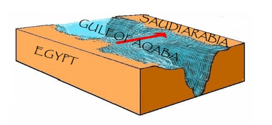
This
bridge appears to have been formed by washouts meeting each other from
two directions – from the Western and the Eastern shores. Perhaps it was
during the closing stages of the Great Flood, that the Lord, in His
foreknowledge, divided the Gulf with this path across the sea, for the
event He saw ahead.
The Scriptures appears to allude to this. There are passages which speak of the Creator having made a:
- path in the mighty waters (Isaiah 43:16-17),
- path in the great waters (Psalm 77:19-20),
- dividing the water (Isaiah 63:12) of this deep trench.
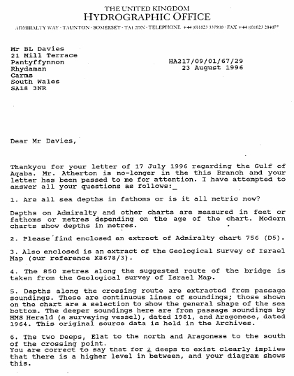
Based
on data from the ETOP05 data base that the greatest depth on this ridge
is only 300 to 320 feet deep. If this is correct, there would be no
noticeable angle of ascent or descent at all, over the 8 mile length of
the bridge.
Please
note that ETOP05 is claimed to be a combination from various data
bases. However, we must say that there remains so much disagreement
between the various sources that we cannot be certain about the depth.
One thing is certain: the bridge is there!
It
was by following Biblical clues (disregarding all previous human
theories) and accepting every word of the Exodus account as LITERALLY
true, that Ron Wyatt & his crew were led to this very spot on the
Red Sea. There is NO OTHER LOCATION that fits ALL the Scriptural
requirements. On the Eastern shore of the Sinai Peninsula there is ONLY
ONE PLACE that is big enough to hold the perhaps 2-3 million people,
their flocks and Pharaoh’s army! And the underwater land bridge extends
DIRECTLY from that beach area! That beach is so huge that it can be seen
from outer space!
What if there was no Underwater Ridge Today?
For
purposes of argument, let’s say that the underwater ridge had over the
centuries become eroded away. Would that negate the mass of Bible
evidence that indicates that spot? Would it eliminate the chariot parts
and skeletal remains found on the seabed?
Suppose
the Bible said that there was once a lush green plain and a valley (the
vale of Siddim) where armies fought in a battle. But today all we can
find there is a desert and a salt (the Dead Sea). Would that mean that
the Scripture was wrong? We must always remember that Geography can
change dramatically.
The
strongest point to be made is the enormous total weight of evidence –
the true Mt.Sinai on the other side of the crossing, with the golden
calf altar, Moses 12 pillars, the boundary fence around the mount, the
split rock out of which poured the water, and so on. The fact is that NO
ONE has been able to find these things anywhere else. The over-all
evidence shrieks that this is the spot!
As we see the weight of evidence accumulating, to keep opposing it requires an extra measure of foolishness.
But
trying to pin a man down to FACTS can be futile. His main goal seems to
be debating the hair splitting meaning of the word “bridge.” It becomes
easier to understand the Lord Jesus Christ’s anger at the Pharisees of
His day who thrived on debating the trivial shades of the meaning of the
word. It was not that they could not understand Him, but that they
would not.
Some
of God’s people can get so bogged down, caught on a detail of something
that to them raises doubt, that they fail to see the weight of evidence,
the overall picture, and as a result miss out on the great blessing
that God is trying to reveal to them.
15) In the Bible, it says that when the children of Israel crossed the parted Red Sea, there was a strong wind. Wouldn’t the strong wind have blown them all away?
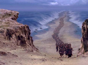
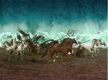
“The LORD caused the sea to go back by a STRONG east wind all that night, and made the sea dry land, and waters were divided. And the children of Israel went into the midst of the sea upon the dry ground; and the waters were a wall unto them on their right hand and on their left.” (Exodus 14:21-22)
Midway
across on each side, the cliffs of water were up to 300 feet (100
meters) high, that’s skyscraper height! Only a MEGA HURRICANE could have
exposed that deeply covered land bridge and pushed and held two walls
of water 100 meters high.
So how did the Israelites not get blown away? Well, our answer lies as always in the Scriptures. Notice Exodus 15:8: “…..the floods stood upright as an heap, and the depths were CONGEALED in the heart of the sea.”
In the dictionary the word “congealed” is defined as; “To change from a fluid or soft to a solid or rigid state.”
Strong’s
Concordance notes that “congeal” comes from the Hebrew “qapha”
(pronounced kaw-faw), which means “to shrink, ie. Thicken (as unracked
wine, curdled milk, clouded sky, frozen water)”.
16) Could Bible writers have wrongly assumed it to be a miracle?
There
are certain events in the lives of men and nations, for which
coincidence is hardly an adequate explanation – events where one senses a
greater, even intelligent, reality working behind the scenes.
Consider
for example, the Red Sea Crossing event. In reading the story, one is
forced to the conclusion that either this event did NOT happen as
described, or it was a miracle.
Well, we can rule out the first option – that it did not occur. We have now been able to document the evidence that it DID.
That
leaves us with the second option…..a miracle. There are just too many
“impossible” coincidences, to call it anything but a miracle.
1. The bridge across the undersea trench – prepared, as it were, ready for the event.
From
two separate land masses, two washouts occur, which form two half
bridges. These meet precisely to form a raised pathway right across the
deep undersea canyon. We know of nothing like this – a canyon so
bisected – anywhere on this planet.
2. At the right time, a strong wind parted the sea, precisely at the bridge location.
Had
the sea split open anywhere else, the fleeing Hebrews would have looked
down a 45 degree drop to about 5,000 feet (1,600 meters) – impossible to
cross. But at the underwater land bridge it was a gently 6 degree
slope, an easy passage for the 8 mile (13km) journey to the opposite
shore.
3. On
each side of this dry passage through the sea, watery walls of
skyscraper height (up to 300 feet/100 meters) were held back.
4.
These walls of water stood firm for hours, until every Hebrew was safely
on the opposite shore, and then crashed down only when every Egyptian
pursuer was on the sea bed. Too many coincidences. A deliverance unique
in history – for a once only need.
17) What has been found on the sea bed?
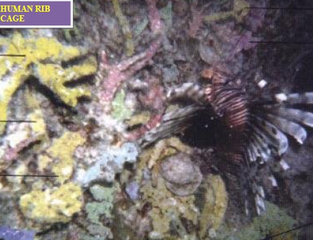
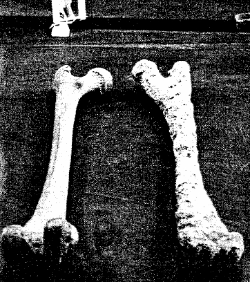
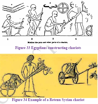
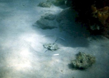
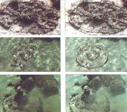
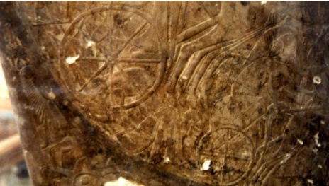
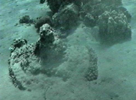
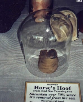
Ron
Wyatt and his team have found the remains of chariot parts, chariot
wheels & skeletal parts of horses and men, ALL CEMENTED IN CORAL.
Because of this, it is difficult, if not impossible, to extricate them
without destroying them.
Ron
Wyatt did extract the hub of a wheel with parts of 8 spokes attached and
presented it to the Egyptian authority. This was sufficient for Mr.
Nassif Mohammed Hassan to identify the dynasty from which the wheel
came.
To date, the chariot parts have never been found in the Red Sea anywhere, except this site!
18) Can the remains be protected from treasure seekers?
One
shudders to think what might be happening to the irreplaceable evidences
of the destruction of Pharaohs hosts in the Red Sea, now that Ron Wyatt
has revealed the true site. This information would undoubtedly draw
hordes of scavengers and treasure seekers well aware of the value that
such ancient artifacts would bring. How can these survive?
The
remains, fortunately, are largely covered with coral, which not only has
preserved them, but also helps to disguise their presence. And –
fortunately – most of the remains lie at the Saudi Arabian side of the
sea, which is out of bounds to tourists, divers, etc. Any divers at the
Egyptian side most now report to a local police officer – and no
artifacts are allowed out of Egypt.
19) If this is the crossing, there should exist the Biblically mentioned sites beyond the crossing – such as Marah, Elim, etc. Have these been found?
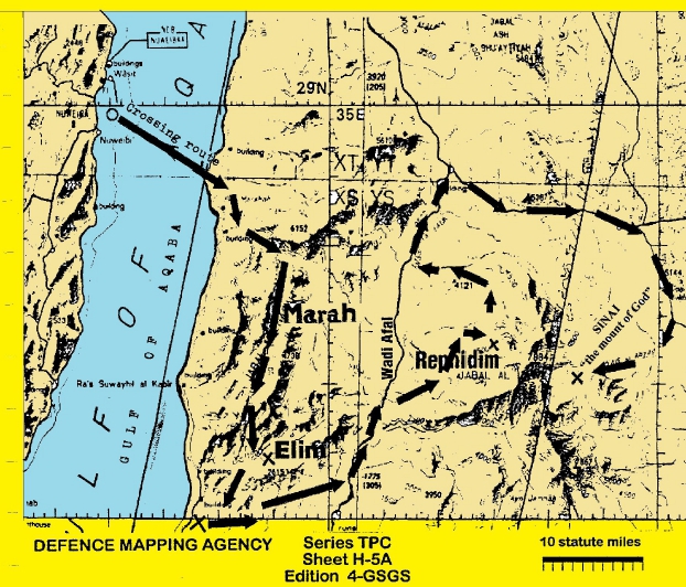
Marah
When the Israelites arrived here, at the coast of Saudi Arabia, the Lord led them to Marah for a drink (Exodus 15:23),
where the water was bitter. “Marah” in Hebrew means “bitterness”.
Today, in North West Saudi Arabia, exists a place named “Bir Alhamdah”,
which in Arabic means “well of sourness” (Hans Wehr Arabic-English
dictionary). The Oxford Paperback Dictionary defines both “Bitter” and
“Sour” as “tasting sharp”. They mean the same. This well is about 25
miles southeast of the landing beach. (Bir Alhamdah is found in N.W.
Saudi Arabia on defense Mapping Agency map NH 36-16, 1:250,000 scale –
28 deg. 30 min. N, 34 degs. 50 min. 30 sec. E.)

Elim
The Biblical record says:
People
working on these discoveries in Saudi Arabia and who have gone into
this region, time and time again and provided wonderful footage of their
explorations, have noticed one major thing. The LACK OF PALM TREES!
Especially considering how plentiful they are in Egypt. There were no
palm trees anywhere throughout the large, dry valleys which led from the
seashore directly east.
“And they removed from Marah, and came unto Elim: and in Elim were twelve fountains of water, and threescore and ten palm trees; and they pitched there” Numbers 33:9.
The
two wide north-south wadis mentioned above end to the south at an
east-west wadi, which again leads back to the sea. And there these three
wadis intersect, there is an extremely large oasis with hundreds of
palm trees, and 12 wells of water.
We
have no doubt that this is the Biblical Elim. The 70 palm trees have
proliferated and now hundreds of their descendants are thriving in this
extremely desolate and arid region.

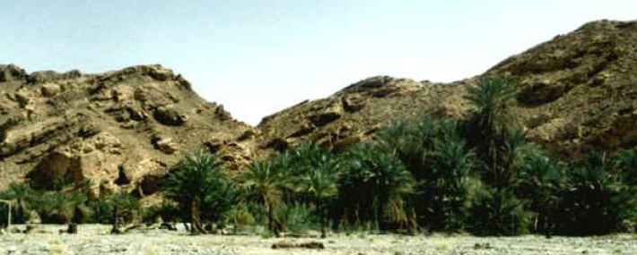
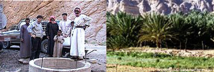
Elim
Dophkah and Alush
Rephidim
Back to the Red Sea
The record continues:
“And they removed from Elim, and encamped by the Red Sea” Numbers 33:10.
Why
did the children of Israel go back to the Red Sea? Did they reverse back
to the crossing spot? Why would they do that? But since the exploration
of this area, we now know why!
This third wadi (the east-west one) leads just a few miles westward to the sea!
From the sea there branches off another wadi, and then they resumed their travel, they would have followed this.
Along
this route they made two more encampments – Dophkah and Alush. We may
never know their exact location, since no information is given.
After
a short distance eastward, they met the Wadi Alfa, which cuts
north-south. They veered left and after travelling the Wadi Alfa between
mountains into an open plain, they immediately turned east into the
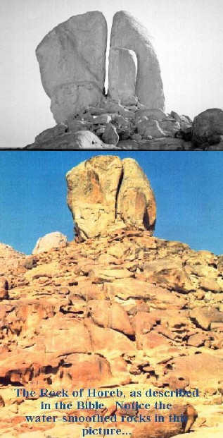
foothills of the western side of Jebel el Lawz. Here they found
themselves at Rephidim. And now the people became very angry at Moses
because of the lack of water. It was here that the Lord caused water to
gush out of the “rock at Horeb”. Evidence which survives here of this
awesome event is given in the “Mt.Sinai FAQs” section.
Jethro
Down
through history, the inhabitants of Al-bad, a short distance to the
south of here, have preserved the memory of Jethro (Moses father-in-law)
who came to visit Moses after the Israelites arrived at the “mountain
of God”. They still claim this day that the oasis of Al-Bad was his
home. Travellers through the region in the 1800’s all recorded the tales
told them about Jethro.
The
stone circles around Al-Bad are called the “circles of Jethro”. Al-Bad
is the only large oasis in the N.W. Arabian plain near Jebel El Lawz. We
firmly believe this was his home and the home of Moses during his
exile.
